Wednesday, 21 August 2013

Day13 Bryce to Springdale via Zion

** PHOTOS WILL BE ADDED SOON - PLEASE COME BACK **

Woke up to cloudy skies, breakfasted in room from stores and were away from the hotel by 09:20.

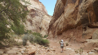
Not far down the road we went through Red Rock Canyon where featured cliffs of deep red came down to the road. The level of redness in the rocks depends on the concentration of Iron Oxide (rust) and can take the view from coral pink through orange to quite a deep red.
As we exited Red Rock Canyon, the red features ceased suddenly and we drove at a steady 65mph through what, on any other day would be a beautiful route but with what we have been seeing day after day felt almost ordinary. The roads again are wide and quiet and driving is non taxing largely on cruise control

The route descended 4000 ft on the way to Zion and the temperature rose from around 20 to 33 by the time we hit the boundary of the Zion National Park about 11:00, at lot earlier than anticipated.

Again we experienced the sudden switch from 'normal' geography to crazy that has been typical of arrival at all the National Parks we have visited.

We joined the queue for a mile long tunnel built 1920s for smaller vehicles that today so operating alternate one direction flow whenever a larger vehicle needs to go through. A coach 5 cars in front of us meant that we followed through in one way which I was quite glad of. Being an old tunnel, there is no lighting, no reflective paint and no side space, the two lanes are immediately adjacent and narrow so oncoming headlights would not have been fun.

We traversed the park and arrived Springdale too early to check in at La Quinta but used their parking lot whilst we walked into the pleasant town for a good pastrami sandwich & salad.

Still to early to check in we jumped on a free shuttle bus from the town to the Park. Parking in the entry area of the Park is limited and no private vehicles are allowed in the Canyon area except winter months. At the Visitor Centre, we transferred to the in Park free shuttle for the 40 minute with stops journey to the head of the valley. It was now very hot and the air con on the buses consisted of every available window and roof hatch being open.

We travelled through highland mountain country, massive cliffs, shapes reminiscent of the Cairngorms but with reds and whites and vivid greens in the valleys. The last stop on the shuttle is the Temple of Sinawava where the 1 mile walk to The Narrow starts. We had a paddle in Virgin River (Branson gets everywhere!), exchanging taking couple photos with an old Dutch guy and his Chinese American partner an amazingly smiley lady.

The shuttles then returned us to Springdale where we were finally able to Check in. We like the La Quinta brand and headed to our room only to find that we were on the end of a building looking at the diggers and workmen building the next lodge in the complex. A miserable view which we really didn't want for the next 2 nights. We requested a change of room and after some discussion have a pleasant room near the pool.

The Narrows, mentioned earlier, is our entertainment for tomorrow. Essentially, you walk beyond where the path finishes in the river upstream through narrow canyons. It is very highly recommended that you hire sturdy water boots and neoprene socks for this enterprise and a stout wooden walking pole to lean on and test depth. The water is heavy with sediment so, though a darker green suggests depth, you can't look through the water to see precisely where your are stepping.

The Wind was suddenly blowing up, dust whipping into the air and the sky going black. Some rain falling but we need to get our gear for The Narrows. We drive rounded to Zion Adventure and meet a very professional service. We sit and watch a video before even fitting kit which shows the dangers involved.. with a little comedy of someone who was the spit of Alan Davies (QI) falling all over and splashing others. Warnings completed we moved onto boot and neoprene sock fitting which got us seriously hot. Lynne's small foot size meant that the tight ankle of the sock presented real problems getting over the rest of the foot. It was exhausting! Kit chosen we were warned that a flash flood warning had just been received and the Narrows may be closed in the morning. A an actual closure means full refund we took our chance, hired the gear after signing risk agreements and dumped our gear in the car.

Next stop buy more water from garage shop then back to room to chill for a while and choose where to eat.

Wildcat Willies was our choice and we had one of the best pasta meals we have ever had. It's a good job we had the same as the pieces of garlic were prominent in the sauce as well as an excellent garlic bread. A bottle of Californian Chardonnay completed the picture nicely.

Across the road to the sandwich shop we had lunch at with a view to a packed lunch for tomorrow but the sandwich bar was closed for the evening. Not sure what we'll do, have to cross that bridge in the morning but we do want to get away early providing the Narrows is open. Wish us luck, the skies are still dark.


Statistics: Miles today: 84 miles; Miles so far: 1809; Fuel today nil gals; Fuel so far: 59.999 gals; States: Utah; Time Zone: Mountain (UK-7)

09:20-12:40

Tuesday, 20 August 2013

Day12 Bryce Canyon Tour Day


** PHOTOS ADDED BUT NEED ORGANISING **
For the past few days, the start of the day has been blue skied and sunny then about 11 the clouds would come in with some rain then for the rest of the afternoon though it would become very hot it would be duller and always with a risk of rain. In view of this, we decided last night that we should start a walk down into the amphitheatre early morning leaving a driving tour for the afternoon.

When my phone alarm went at 7:10 I didn't feel like getting up. I hadn't slept well and was very tired and my stomach was a bit dodgy, however we pushed on and not bothering with a shower we had breakfast in the room and were out and at walk start at Sunset Point for  9 o'clock start.

Early on descent
Even at this hour, there were plenty of people about though they were good company. The Walk was only 2.8 miles but dropped 600 feet down into the amphitheatre to wander amongst the Hoodoo's. A gradual winding drop, it was already hot and by the time we reached the top again, the 2 litres of water we had with us was gone. The rim is around 9000ft and we have been at 6 to 10,000 for the last 3 days so have acclimatised quite well but though 9,000ft is not that high it is still noticeable that oxygen isn't as forthcoming.

The experience of this walk can only really be told in pictures, the descent was gradual and winding through orange rock and in the valley bottom dried up stream bed wandered amongst fir trees and coloured rock towers.

We found the ascent easier than expected. A narrow track made its was through narrow canyons and gained height quickly in a constant series of tight switchbacks. The massive advantage of this geography was that the canyon's steep narrow sides kept us in the shade for most of the climb. By the time we reached the rim shortly after 11 the heat was stifling and clouds were appearing. As we reached the car the first drops of rain fell.


Route back up

We changed our address to Smug Lane, Smug, Smug City.

Driving down to the Lodge in the National Park, we headed for the a general store which served sandwiches, pretzels and drinks which we enjoyed on the patio outside.

After lunch, we headed back to our hotel for a shower and change of cloths. I caught up with some planning and notes for blogging and Lynne washed a few tee shirts and underwear before we headed out to the Park again.

A road runs right through to the end of the Park, which is actually a small one with several view points along. We drove straight through to the end mainly in rain but the clouds parted when we reached Rainbow Point and we went for a 1hr amble through the pine woods seeing remains of Bristlecones (talked of in Capitol Reef post). From there, we moved along the road stopping and looking at views as we went including at a natural arch.

We revisited Bryce Point from last night as the best view of all. Today the light is still high and shadows form amongst  the hoodoos. The view changes constantly with light but we think the morning light was the best. A final view point Inspiration Point just because it meant we could see the area we had walked then off to a Pizzeria near the lodge where we had an excellent salad, pizza and beer meal.


Returning to Ruby's Inn city we wandered through the shops, owned by the same people as the Hotel, Garage and Campground. Ruby's Inn city was founded in 2007 :).

Back to our room with some beers from the Ruby's Inn general store to TV, blog writing and bed.


Statistics: Miles today: 78 miles; Miles so far: 1803; Fuel today nil gals;  Fuel so far: 59.999 gals; States: Utah; Time Zone: Mountain (UK-7)


08:30-20:00

Day11 Torrey to Bryce

** PHOTOS WILL BE ADDED SOON - PLEASE COME BACK **

We woke up to a view out of our window with horses and a barn on a lovely morning having slept very well. Breakfast was good apart from little cartons as the orange drink and no fruit.

We called in at the General Store in Torrey to collect stores for evening meal and breakfast as food at the next hotel is not well spoken of with regard to service and quality and there is nowhere else to eat.

We headed out to Route 12 which is considered a scenic route and very well spoken of in travelogues expecting the red rock and cliffs of yesterday at Capitol Reef but instead headed across pastures in green valleys with cattle grazing. We encountered 2 cows loose on the road where there was wire both side so it was clearly not open grazing. A quarter of a mile down the road we saw 2 cowboys by the gates of a cattle ranch on the left. The guy inside was sorting out the horses whilst an old guy in full checkered shirt and stetson even with spurs on his boots leant against the gate one leg up on a spar. We pulled over and circled the car right up to him whilst he dedicatedly ignored us. I opened the window and shouted over whereupon he deigned to glance around. I told him of the cows on the road to which he simple responded with a single thumb up and returned to watching the other guy. Communicative chap.

Continuing on we climbed and scraggy scrub land took over before turning into rolling forest of Ponderosa pines followed by Aspen with tall thin white trunks and green valleys appeared hear and there. Over the forests and the scenery opened into wide views of Capitol Reef and Waterpocket fold tinged orange and then massive white features began to take over the whole scene.

In every direction the landscape filled with white rock in domes and escarpments, towers and gullies. As far as the eye could see white and orange monuments spread away to blue hills in the distance.
At one point, the road travels across a ridge, the Hogs Back, dropping down to either side.  We turned and passed a second time to take it in and at the end notice a motorbike with UK plates. Stopping and chatting to the retired couple they had been throughout Canada, toured all sort of part of the USA including Alaska and were carrying on 'till their visa ran out when they planned to head down to Mexico. True adventurers.

The odd features continued at one point seeing our first true canyon.
All along this are there are remains of the Pioneer days when the Mormon settlers moved in these areas. The stories of road built are amazing with tens of wagons heading out with families on board and journeys expected to last 6 weeks taking 6 months. The men would go ahead blasting and shovelling before the train moved forward and the final stop point would be the latest that the land could be irrigated in time to plant crops for the season. Lynne loves these histories so a lot of information boards got read.

Approaching lunchtime, in the distance more dramatic orange features and the coloured horizontal layers in the rock became clearer as we arrived at the town of Escalente.
We had read of a burger shack called Nemo's which was loved by and had our minds set on eating there and having their ice cream. We found it quickly and read the notice on the door, closed for 4 days! Somewhat disillusioned we passed through the town and took a chance on Circle D bar and grill which turned out an excellent choice. A fine burger and fries in a nice atmosphere with very friendly service.

Nearing the Bryce area we pulled into a store at the town of Tropic and were tempted by ice cream. Stood next to a family from Bristol UK, we had choices including Cake Mix and Cookie Dough. The Cake Mix did taste like scraping the bowl after my Mum had backed when I was a kid but the size of a single scoop actually defeated Me! and I had to bin the last of it. The girl serving was very chatty and when hearing of someone in difficultiues at Zion said, "Oh, my dad will have been involved then, he's the local cop.", somehow, it felt a small world out here.

Continuing on, towers of red sand features announced our arrival in Bryce area and we drew into Ruby's Inn city, a conglomerations of hotel, restaurant, shops etc. The hotel sprawls with many annexes and lodges attached but we are in the main part and our room is fine.

After booking in, we headed to Bryce Canyon Park entrance which is literally 5 mins from the hotel and called in the visitor centre to collect info' and maps to plan our visit.

Returned to the hotel and microwaved our meal bought this morning before heading out to Bryce Point about 20 mins into the park. Here we had our first sight of the 'canyon' which actually isn't a canyon but 3 amphitheatres. Description is impossible of this weird beautiful sight. 'Hoodoo's and fins of rock from white and coral pink to deep orange extend all around below a rim that when approaching is just a rolling thin forest. We stayed until about 8:30 watching a cloudy sunset as the hoodoos faded into the gloom.
This are is famed for it's dark star filled skies but we have a full dazzling moon & cloud so can only see a few.

Back at the room, tired after a long day we down a beer and here in southern Utah 7000 miles from home watch English TV: Yes Minister & As Time Goes By.


Statistics: Miles today: 121 miles; Miles so far: 1846; Fuel today 9.058 gals;  Fuel so far: 69.057 gals; States: Utah; Time Zone: Mountain (UK-7)

10:00-16:40

Sunday, 18 August 2013

Day10 Scipio to Torrey via Capitol Reef

Utah is Mormon country and everything tends to be tidy, roads are wide, houses are more finished and since we neared Scipio irrigation seems to be no problem even to the point of neat manicured lawns around some buildings. An total contrast to Nevada and the deserts.

Leaving the town, the whole area is softer on the eye with a gentle green even through the golden late summer pasture. Agriculture now includes tall fields of sweetcorn and cows graze in the wide valleys. An addition decoration is would sunflowers growing in the verges.

Progressing south east through pleasant lands and finished small towns we curve gently around and over the country with very few long straight roads.

Passing our hotel for tonight at Torrey, we carry on toward Capitol Reef and bending around an escarpment
we are suddenly faced with the extraordinary red country of Southern Utah which we will be exploring over the next few days.


Exploring the Capitol Reef National Park is largely driving scenic roads and tracks. We extended the 12 mile scenic drive along a metalled road by a further 2 miles of un-metalled road into a gorge with massive vertical red walls and then parking at the end we hike the trail along the Capitol Gorge Road which one carried traffic through to the next valleys. On the walls of the gorge are pictograph's (drawings) from early native American inhabitants and then names and messages from pioneers from the late 1800's through to the 1930's.


On the way back down the scenic road we diverted again into Grand Wash Road, again un-mettaled, and wound leaving a trail of dust through the gorge. The term 'wash' means that this dry sandy channel is actually a flood in storms and warnings are displayed not to enter if storms are due. An enjoyable ride and interesting for being part of the actual area that Butch Cassidy and the Sundance Kid hid out in.

More roads with some local history of families and schooling where shacks and building still stand then back to the hotel for a sensible time. Made use of the indoor pool and the hot tub then drove to a bar the other side of town for a meal.

The Saddlery was a cowboy themed bar restaurant with music most nights but not this so was quiet. Poo, table down one entire side of the room and a dance floor at one end. We decided this was definitely the place for steak but, though everything else was great, my medium-rare was well done. I did the un-British thing of pointing this out when ashed how is everything. I declined a replacement as it would disrupt our meal but was please to be given a discount and apology when the bill arrived.


Eastern extreme of journey
Today we reached the Eastern extreme of our journey and now head south before going west again.


Statistics: Miles today: 151 miles; Miles so far: 1725; Fuel today 9.468 gals;  Fuel so far: 59.999 gals; States: Utah; Time Zone: Mountain (UK-7)

9:50-18:10

Saturday, 17 August 2013

Day9 Ely to Scipio via Great Basin

Forgot to mention yesterday seeing nodding donkey oil pumps and desert racing, trial bikes and dune buggies. Seemed to be a big deal with camps of RVs, marshal points at road crossings and trucks with tanks on there roof filling up at garages.

So, to today. Today was a day another day of wide vistas. 
Great Basin from Wheeler Peak Scenic drive
We left Ely heading over a ridge and hit the roads go on for miles in a straight line again. The first half of the day is in the Great Basin, a massive flat area surrounded by hills. We head to the Great Basin National Park area. As always we had an outline itinerary in mind to be used as a baseline but ready to change to fit time.
Options included the Leghman Caves but after talking to the guy at the Visitor Info Centre we found it was a 1:30 tour at booked times and with another 200 miles to go after this visit we knew the latest we could be away was about 2:30. We decided to stick to the Scenic Drive 12 miles up Wheeler Peak to 10,000 ft and a 2.5 Mi trail to visit the Bristlecone Pines.
3,200 Years old and still alive (tree)

The Bristlecome Pines are extraordinary trees living as much as 4,000 years. When the trees die they do not rot being intensely resinous but stay in tact and simply weather. Cross matching ring patterns from living and dead Bristlecones has been used as a way of bench marking carbon dating. One living tree was 3,200 years old taking it back to having been a sapling before the pyramids were built in Egypt.
At the trail-head car park it began to rain just before we left and we thought we'd let the heaviest pass, 2 mins later it was hail stone!  We set of with waterproofs in 16 degrees and at 10,000 feet noticed the difference in effort but is was a lovely walk and the trees, though just trees, were intensely interesting.
Looking up to cwm under Wheeler Peak
At the top of the trail we also had views up to the albeit small glacier and massive corrie under the high top of Wheeler Peak.Occasional thunder rumbled overhead and we had a couple of showers light enough to shelter under trees. 
Still Waiting for the RAC


Returning to the car, the temperature went from 16 up near the pines to 35. We had lunch, sandwiches purchased this morning, and headed off now 3 pm.
That's 18 miles
Dropping down into Grand Basin itself, the roads extend as far as you can see. I remembered to check on one straight and it was 18 miles without so much as a wobble. Though the land around is flat,
there are hills in every direction and charging along with cruise control set the drive is a pleasure.  


It's not long before we hit the state border and leave Nevada heading into Utah. This arbitrary line also means that we lose an hour as we move from Pacific to Mountain time. Utah has a 65 limit on open road where Nevada was 70 but I may have pushed the envelope a little from time to time.

We eventually leave the Great Basin and pass high into Skull Rock pass dropping through tight curves to the next massive open area. The geological monoliths of the pass form shapes like Mexican temples and in the distance huge cliffs stand with black and white strata clear in slightly off horizontal.
The next open vista includes a massive salt lake but sadly we pass several miles away so don't get to actually see the surface close up.


Around the town of Delta, the desertifiied earth changes to pasture, at first the circles of green you see from the air are on google maps. These have an irrigation frame on wheels travelling around a central water feed point, hence the circle. After this we see fields of corn, wheat and silleage being collected, all a new sight after the dried out barren areas we have travelled. By the time we are close to our destination, gold coloured pasture extends toward the hills lit by the lowering sun.


Having lost the hour to the wonder of time zones we arrive at our hotel at Skipio at 7pm. Not too bad considering we left Great Basin so late but the only places to eat are Dairy Queen (a burger place) which closed at..... 7pm and Subway. Great, Subway will do. Notice on door "Sorry for inconvenience, we are closed at 7 tonight". Aarrrgh!   SO, tonight gourmet dinner was a garage shop microwave burger and re-hydrated noodles with fruit salad and a bottle of Pinot fortunately purchased this morning which made everything better.


Statistics: Miles today: 237 miles; Miles so far: 1574; Fuel today 9.54 gals;  Fuel so far: 50.531 gals; States: Nevada, Utah; Time Zone: pm Mountain (UK-7), am Pacific(UK-8)

10:40-19:00 (Mountain) 18:00(Pacific)

Friday, 16 August 2013

Day8 June Lakes to Ely

** PHOTOS WILL BE ADDED SOON - PLEASE COME BACK **

We woke in our cabin to the sound of bird song surrounded by trees which was novel for this trip. We had breakfast with us, (including two bowls of cereal from yesterday's hotel - naughty), so were able to get on the road just after 9am. Today is very much a driving day with 330 miles to cover so we're aware we must keep moving.
June Lakes sits in a loop of road running through a valley so we set off north having approached from the South. The Sierra hills are beautiful and open up over Silver Lake, a large lake backed by forest and cliffs already populated with small boats and fishing parties from the camping parks alongside.

In the early part of our journey we visited Mono Lake which is geological oddity. It has no outlets and water level only drops naturally due to condensation. Some years ago Los Angeles started taking water from it and the level dropped considerable causing the already high concentration of salts to to escalate. Underwater springs rising from the bottom created tufa towers, the equivalent of stalactites but going upwards from the lake bottom. As the water level fell, many these formations are now on land or rising out of the waters. A particular breeds of flies live on the salt and create black strands which come alive and buzz loudly as you walk through them, however, they stay 1" above the floor and are not interested in flesh so are not unpleasant.
Leaving Mono Lakes on the 102 we are faced with "42 miles of narrow winding road" but the road remains a full carriageway and the bends for the most part can be taken at 50mph.
This road does have a feature that several people have told us to enjoy. The tarmac is just laid on the rolling land with no attempt to flatten and sections are like roller coaster rides switching between downward G force and weightless stomach. A few too many too fast makes you feel very odd. Have to watch the blind summits, more for a bend after than oncoming traffic as it's all double lines no overtaking.

We have crossed into Nevada so now has a 70mph limit and we begin to encounter the desert. The textures vary throughout the day but this early section looks like a tarmac car park 20 miles across that has been abandoned and the weeds are breaking through the surface. We encounter road heading many many miles in straight lines and pass through lunar scenery with rock strewn dust, salt lakes, rolling areas of low brush, low hills full of different colours from mineral deposits.It's notable that we are 50 miles north of Death Valley and a lot of the scenery is familiar. At one point we see a small twister travelling along and crossing the road half a mile ahead.
This area has very few towns and you have to make sure you have sufficient fuel. Looking at today's drive on Google Satellite reveals a burnt out uninhabitable zone. It is extraordinary that there are a couple of tiny towns, one announced its population proudly as 13 and a half.

Eventually, about 30 miles short of our destination we head through a pass and some colour comes into the vegetation.

Booked into La Quinta which is as well because there is no available accommodation due to a Fair and Horse races this weekend.


Statistics: Miles today: 327 miles; Miles so far: 1337; Fuel today 4.359 gals;  Fuel so far: 39.991 gals; States: California, Nevada; Time Zone: Pacific(UK-8)

09:15-18:00

Day7 Oakhurst to June Lakes via Yosemite

** PHOTOS WILL BE ADDED SOON - PLEASE COME BACK **

Breakfast at the Comfort Inn Oakhurst which proved to be a perfectly adequate lodge for our two nights. We have found picking up a Subway as a lunchtime sandwich very effective and we had one across the road so collected that, filled up with fuel and headed off for Yosemite around 10:30.
Our plan was to visit the giant sequoias at Maricosa Grove which is just inside the park but all the parking lots were full and we would have had to use the shuttle but from 4 miles away. This type of holiday is marked by having to decide what not to do as you did in here and there. Before you leave everyone has what you must see, do and where you must eat but you have to play it as it comes. We decided that seeing the sequoias here would have too bad an impact on the day.
We drove straight through non-stop to the central valley as we had seen it all yesterday then joined the road up to the Tioga pass which would take us East over the mountains.
On the North side crossing the attractive creek where families played we passed directly under El Capitan. From the meadow adjacent we could just see 2 climbers high on the face. The climb is over 3000ft up a vertical face and apparently takes most climbers 3 days bivouacking on ledges on the way. We know this as we chatted to an old Dutch guy in the meadow who had climbed it in his younger days. It seems the hardest aspect is the temperature, many hours on the face in excess of 30 degrees and the rock is also hot to touch.

Shortly after the road intersection in the valley we reached Tuolumne Grove, another of the few location where Sequoias can be seen. A mile and down 400ft from the car we saw trees as wide as 10ft and over 300ft tall. Some of the Sequoias in the park are 3000 years old predating Christianity and Roman empires. We were just about to head back up the 1 mile 400ft hike when some little buzzing b**stard decided to take a chunk out of Lynne's arm so we headed up rapidly to get to the antihistamine cream. Her arm still hurts now 8 hours later but seems ok.

Yesterday's Southern side was carpeted with pine forest but the North opens out more with bare domes of granite rock scattered with trees hanging on in cracks. We stop occasionally marvelling at different views but generally keep moving. On sop late in the journey looks back across high ground to Half Dome. Asa we reach the eastern side of the Sierra the terrain changes from domes of solid granite to volcanic with softer stone and reader hillsides.  Finally, we see Mono Lake and drop down to the plains, a diversion to Lee Vining to the general stores and then down to June Lakes.
I had expected more sharp dark peaks but the area is a softer low mountain scape, sitting around 8000ft with sage brush giving the hillsides that frosty colour.

We're inside now at Reverse Creek Lodge. Our lodge is a wooden building with about ten others, compact and quaint. Pizza and Garlic bread cooked and eaten and most of the wine drunk.  There is an amazing dark sky but our neighbours have their outside light on :( and there aren't many gaps in the trees overhead.  I'll have another look later.  Good night.

Statistics: Miles today: 136 miles; Miles so far: 1010; Fuel today 9.2 gals;  Fuel so far: 35.632 gals; States:  California; Time Zone: Pacific(UK-8)

10:30-18:45

Day5 San Francisco to Oakhurst


After 2 nights in San Francisco we had began to feel settled. Sort of sorry to leave, we liked it here and it was nice to put down roots for a short while.

Breakfast in our room with cereal and pastries from the Seven Eleven across the road and coffee from reception. With the sun shining and the temperature up, we loaded car before taking a last walk out by the sea front. Along the wharf, under clear skies the Golden Gate Bridge is visible right to top of the pillars.
The Americas Cup will be here in a few weeks and the Oracle boat is a constant sight in the Bay.

On the way back to the hotel, we picked up a Subway for lunch before collecting the car and heading off for the mountains, over 200 miles today.

We leave the city going by the point where we had first seen the bridge two days ago then turn onto the bridge heading North. At the far side, we pull into the public viewing area which is very busy with cars and coaches but we find a space to park. Listening to everyone around, the Americans seem to be in the minority.

Intending just to look along the span we end up walking out to the 1st tower. The footpath is shared with masses of hired bicycles and if you stop to look up you need to make sure you stay to the side. More than once I had to apologise. Watching a Red and White ferry come out across San Fransisco Bay and spin around under the bridge reminded us of our trip yesterday.  We stayed too long and took far too many photographs before heading off East and crossed the Bay again on another bridge taking us to the mainland.


In the distance San Fransisco appears as a ghostly image in the haze across the bay with Alcatraz Island sitting off shore.


Leaving the coast we pass through rolling golden hills then flat agriculture with mile after mile of almonds plus other fruits and some vines. Only 20 miles inland the temperature is up to 35C (95F) from less than 20C (68F) at the coast.
The plains give way to increasing climbs and long high roads with switch backs, long drops and not a barrier in sight.

 Time is getting on and we haven't seen anywhere to stop to eat. At 3, we pull off the road into a lovely stop with sme shade surrounded by golden grasses and California Oaks. It is 37C (99F) with a gentle breeze, it feels like standing in front of a giant fan heater.

Finally dropped down into Oakhurst and our hotel at 5 in the afternoon. It's still 37C and we have a quick dip in the pool before walking down to Pops, a small restaurant, for a very really nice meal and a beer.
Satisfied, we walk back up the road in a pleasant balmy evening twilight and try to catch up on blogs.

Very noisy air con' unit but no choice over using it, it's hot! So far, on this trip, we have never had reason to switch one on.


Statistics: Miles today: 227 miles; Miles so far: 743; Fuel today 7.774 gals;  Fuel so far: 26.432 gals; States:  California; Time Zone: Pacific(UK-8)

10:00-17:30

Day4 San Francisco Tour Day

** PHOTOS WILL BE ADDED SOON - PLEASE COME BACK **

Our San Francisco day started with walking around the corner for breakfast at IHOP which consisted of blueberry pancakes and french bread with apricot and pecan with orange and lashings of coffee. We left absolutely stuffed agreeing that we couldn't do that regularly. Most of our hotels have breakfast so it won't be necessary.

We ambled around Fisherman's Wharf in cool but bright sun and purchased the obligatory San Francisco logoed clothing item. A gray hoody, I was frozen last night.

One of the quays has been given over to a Sea Lion colony which moved in a few years ago and has become an item to see. The barking can be heard over much of the wharf as younger ones fight for places in the sun pushing and tipping each other off into the water and the older ones plant themselves basking in the sun.

Alcatraz sits out off shore. Lynne had been keen to go on the tour but all tickets on the Internet whether sold out when we tried over 3 weeks ago. About 50 tickets are released each morning at 6 but our hotel reception told us that people queue as early as 3 so we  abandoned that thought. Several companies operate tours of the bay and we went on the Red and White Ferry, a 1 hour trip with a good commentary out to the Golden Gate bridge and then back around and very close to Alcatraz island. It was a really enjoyable trip with great views to the Golden Gate Bridge, and back to the attractive city with the tall buildings of the business district as a background. The cloud bank crawled over the towers of the Bridge obscuring the tops and into parts of the city with the Sutro radio tower popping out of the top of it.

Yesterday evening Lynne had convinced me to try one of the Clam Chowder samples being proffered outside the stalls and I had rather liked it. I would describe it as tasting like chicken and mushroom soup with bits that texture wise could be vegitable in nature.  With that knowledge, today we had Clam Chowder from the Boudin bakery in a large hollowed out sour dough cob which made an excellent lunch sitting outside the bakery.

Afternoon was beautiful with a clear blue sky though still cool in the wind and out of direct sun.
Lynne had spotted a driving tour following a scenic route for the afternoon. It was actually a 49 mile route but we cut it short at the city limit.

Before joining the route, we headed to the postcard favourite Lombard Street switchbacks. We had to circle round a few roads to get the back of the queue which had developed but felt it had to be done. The queueing on approaching straight roads with massive uphill gradient was more freaky that the descent down Lombard which was easy at a slow pace. Not really worth the wait but if we hadn't we'd have felt we'd missed out.
The highlight of the driving tour was Twin Peaks where we had an amazing late afternoon view of the city below with the sea mist drifting across in waves varying the panorama from sharp bright city through ghostly pale to invisible in cloud. All with a clear blue sky above as the bank of cloud drifts low across.

We headed back to the hotel for a while which is in a great position on a few yards back from the main Wharf area then after freshening up we headed out for the evening.
An excellent burger in Wipeout with Nevada Sierra draft beer then we ambled around the quay and explored a museum of fairground machines, everything from What The Butler Saw through slot and pinball machines, Space Invaders and Driving Games all in full working condition.
A contented stroll back to the hotel, hot chocolate from reception before a welcome sleep. All in all, a very good day.

Update on Blog Post progress

Time provedng difficult with long days so I am having difficulty keeping up with Posts. I will re-visit any outstanding material as soon as possible and keep this post as a progress indicator.  Ged

Days1, 2 and 3 all completed on trip.

Day4 San Francisco Tour Day
20/08/13: Content now written up; Photos stat's and map still outstanding

Day5 San Francisco to Oakhurst
18/10/13: PUBLISHED - written up from notes made at the time and photo's added

Day6 Yosemite Tour Day
Statistics ok; ## No Map; No content written up yet; No Photos posted yet
29/8/13 Returned to DRAFT

Day7 Oakhurst to June Lakes
No Photos posted yet; otherwise complete - not proofread

Day8 June Lakes to Ely
No Photos posted yet; otherwise complete - not proofread

Day9 Ely to Scipio via Great Basin
complete - not proofread

Day10 Scipio to Torrey via Capitol Reef
complete - not proofread; photos need tidying

Day11 Torrey to Bryce
No Photos posted yet; otherwise complete - not proofread

Day12 Bryce Canyon Tour
No Photos posted yet; otherwise complete - not proofread
Photos added but need tidying

Day13 Bryce to Sprigdale via Zion
No Photos posted yet; otherwise complete - not proofread

Day14 Zion Nat Park Tour
Stat's posted only
29/8/13 Returned to DRAFT

Day15 Springdale to Las Vegas
Stat's posted only
29/8/13 Returned to DRAFT; Map added; Basic notes inserted

Day16 Las Vegas to Ridgecrest
Stat's posted only
29/8/13 Returned to DRAFT; Map added; Basic notes inserted

Day17 Ridgecrest to Venice Beach
Stat's posted only
29/8/13 Returned to DRAFT; Map added; Basic notes inserted

Day18 Los Angeles locality
29/8/13 Created DRAFT; Map added; Basic notes inserted; minimal stat's

Days19-20
Draft: some notes only


Tuesday, 13 August 2013

Day3 Monterey to San Francisco

We took our time getting away this morning then headed north on Route 1 through flat acres of agricultural land growing strawberries, apricots, cherries and artichokes amongst other things. Once again, the sea mists hang over us, 14 degrees and windy.

I have a niggling discomfort about being in an earthquake zone and the Tsunami warning signs are always there to remind me.


When we hit the resort of Santa Cruz we encounter clear blue skies though it is still only reaching 20.
Santa Cruz looks a nice place, we diverted down to the beach area which was extremely busy being Sunday. A stunning beach was full of families and volley ball players and along from the beach ran a fun fair which included an old wooden roller coaster (which apparently is shown in many films which are supposed to be Coney Island New York). There were massive queues for parking so we simply circled and left again but were very glad to have seen it.  Leaving wasn't so simple and we had repeated abortive wrong turns with traffic jams as we tried to recover. Eventually, we were on the road North again and just as we left town there was a Safeway and a Subway both of which offered lunch but having only just got going I made the rash decision to drive past.  Of course, the next 40 miles had nothing.  We stopped for gas and bought a pitta sandwich from the garage shop which actually turned out to be very nice though it was around three o'clock by now.

We stayed on California Route 1 as much as we could being the Pacific Coastal Highway and
eventually as we rounded a headland had our first sighting of the Golden Gate Bridge through the trees.  The classic view with the cloud sitting on the towers so that only the span and legs can be seen.

We carried on into town following a tourist tour route and finally across to our hotel which we found easily and we were delighted with it's location less than a block back from the Wharf and close to much of what was happening. Parking was included on the premises which had been an attraction when booking.

After checking in, I sorted a walking route to Chinatown missing most of the hills and we headed off for our evening meal in a classic, "you're drinking green tea and paying cash", establishment with food that we really enjoyed. 

We had an amble through the streets but apart from fairly tacky Chinese souvenir shops not much was going on. I spotted that if we went up hill 2 blocks we could intercept a cable car route though we had been warned it was difficult to get on en route as they were usually full. Within a couple of minutes one arrived and we got on. Inside, though you knew it was a San Fran' cable car, it didn't feel any different to being on a tram but a space came outside and we sat on the side with our legs out to the road being pushed together on the steep hills. It ended up a very enjoyable ride and we deleted our planned ride the next day from our itinerary as we didn't think a busy daytime ride would come close.


Statistics: Miles today: 134 miles; Miles so far: 483; Fuel today 12.318 gals;  Fuel so far: 18.658 gals; States:  California; Time Zone: Pacific(UK-8)

11:00-16:30

Sunday, 11 August 2013

Day2 San Simeon to Monterey

We woke and breakfasted with a grey skies and needing jeans and jerseys.

We headed up promptly to a pre booked tour of Hearst Castle which is an extraordinary complex built high
in the hills by a media mogul. The size of his ranch was summed up by, "he owned the view", which extended to the coast and the mountains. The main house is actually an earthquake proof reinforced concrete edifice faced with Utah limestone and has all the appearance of a grand Italianate church. The building work never stopped until he died and as you go around the back you see parts where the concrete is still visible with the recesses ready to take ornate stone window frames. The still beautiful pools and gardens were hosts to all the famous visitors between the wars. Positioned high, the ranch sits above the sea mists looking down to the grey bank out at sea which is making our journey dull. Interestingly, the gardens are full of flowers which are in our garden at home, begonias, antirrhinums, dianthus, phlox and many others.
The house is not 'authentic' but is full of genuine Italian and Spanish ceilings, fireplaces from French châteaux and tapestries, marble etc from all over Europe.

The Big Sur runs from San Simeon for 90 miles to Monterey along a remote section of coastline.
The sea mists todays are drifting in and above us, occasionally a blue sky is up there and other times the mists shoots above us at 45 degrees. The day continued cool from 16 to max 20 degrees max.

At first constantly stopping to take photos though actually, if you've driven Scottish and Brittany coasts a lot of this road doesn't reach 'spectacular'. The Northern section is more dramatic with inlets, viewpoints and some good bridges.

A highlight not far North of Hearst Ranch is a bay where elephant seals live. We thought we may see the odd one at a distance but there were tens of them of all sizes, some slobbing on the beach in the sun like giant black slugs and all ages and sizes. Others were in the sea and though they are lumbering and slow the power when they decide to argue is awesome. Quite an experience.


A little over half way we stop at a State Forrest Park and walk around the giant redwoods. A very pleasant break from driving.


Just before Monterey we diverted through a pretty town of Carmel then pulled into our hotel at Monterey. Monterey is a pretty relaxed warm evening stroll place with a beautiful beach, large marina and fisherman's wharf piers. We drive down and park near the wharf and enjoy the place but we are cold with waterproofs zipped up for warmth and against the gentle drizzle condensing out of the mist.


Days 1 and 2 tracks:


Statistics: Miles today: 103 miles; Miles so far: 349; Fuel today nil gals;  Fuel so far: 6.34 gals; States:  California; Time Zone: Pacific(UK-8)

09:00-18:40

Day1 Marina Del Rey (LA) to San Simeon

Comfy bed but body clock remembering at 6am that it was 2pm UK time though still managed some good sleep and breakfast was excellent.

Headed to a supermarket with instructions from reception but missed the turn. No matter I thought, a right turn and around one block would return us but 5 mins later we came out opposite our hotel that we'd left 10 mins earlier. Second try worked and we stocked basics, water, crisps, sandwiches for lunch, a few beers and a polystyrene cool box (we use ice out of the hotel machines in a plastic bag to cool the box).

Set off North via Santa Monica along roads one back from the sea and the following to CA route 1 Pacific Coastal Highway and highway 101.  Much of the "coast road" is actually inland and the 101 Freeway does not run freely often 30mph or less. Avoided the PCH through Santa Monica which is a very attractive palm lined resort familiar of the French Riviera and then on through Malibu where the homes of the rich line the hillsides. To now, all has extended from LA but after Malibu we leave it behind and as we go North we see the huge agricultural aspect with orchards and plastic tunnels giving way later to vines. The terrain is hilly and the vines cut off sharply at the top of sheltered dips to beautiful pale rolling prairie pasture.

The weather has improved and we have blue skies and pleasantly warm sun and we pull off at Santa Barbara for a beach picnic watching pelicans flying low over the sea then soaring and diving wings folded into the sea for fish. Getting late when we leave Cabrillo beach but the scenery as we drive over high passes is beautiful and leaving the congested 101 behind we make excellent time and get to San Simeon around 6:30.

Nearly blundered en route when I pulled into a gas station, picked up pump with green handle before noticing it was diesel. I had forgotten that its generally petrol black, diesel green in US station. I put on 6.5 gals (about 32ltr) for $25, about £18!!!!!

Evening is sunny but cool windy with a bank of grey cloud on the sea so fleece and zipped up jacket for a walk to the sea. A friend had suggested sitting with a bottle of wine to watch the sunset but tonight is sadly not one of those nights. However, returning from the restaurant across the road, a crescent moon and the planets Venus and Saturn light the sky reflecting in the ocean.

Statistics: Miles today: 237 miles; Miles so far: 246; Fuel today 6.34 gals;  Fuel so far: 6.34 gals; States:  California; Time Zone: Pacific(UK-8)

10:00-18:40

Thursday, 8 August 2013

Outward Travel Day

We had 2 free days before leaving so what were we doing the previous day at 6pm ? Visiting Argos to buy a suitcase!

Seemed odd this morning for a holiday departure, alarm at normal work time and a taxi at 8:30 for a 10:05 departure. Security an Manchester was very busy in spite of being domestic but we were pulled out and sped through so it ended up quite casual.

Shuttle to Heathrow was spot on time which was good as only 60 mins transfer time.

Through Flight Connections we felt under pressure already, gave up on a Boots for water due to an enormous queue then panicking after losing 10min at WHSmith "fast" self checkout, rubbish machine and slow assistance on repeated lock ups.

Rushed through connections not sure what security we yet had to go through and feeling that we were running out of time, lift inevitably kept opening doors before finally going.

Finally rounded the corner to gate B45 to be greeting by total calm and no movement, and a Boots with no queue!

Boarded LA flight on time and settled in for an 11 hour flight.


Gee, that was a long flight, couldn't sleep at all & knees seized up. Landed slightly early but our gate had a load of luggage carts parked so we got pushed into an ally to watch 5 other planes get processed first. Through security rather slowly due to one seemingly over zealous agent talking to people for ages. We got him and he was actually a nice guy. The good news was that our luggage had made it via Heathrow and was on the carousel as we arrived so we were out for the car rental shuttle an hour after disembarking.


Picked up a silver Ford Escape SUV and headed for Marina Del Rey and our hotel for tonight.

Looking forward to a good sleep after 23 hours awake of which 11.5 was spent in the air.


Statistics: Miles today: 9 miles; Miles so far: 9; Fuel added so far: nil gals; States:  California; Time Zone: Pacific(UK-8)

Monday, 5 August 2013

An Adventure Begins

Lynne and I have often talked of returning to the USA since our Coast to Coast drive in 2008 the story of which I blogged at http://gednlynnecrossusa.blogspot.co.uk

Lynne has often expressed a desire to see the Big Sur coastal road North from LA toward San Fransisco and so that was the start of this trip's design. We enjoyed the extraordinary variety of National Parks which we visited in 2008 so we have developed a route taking in a selection of Parks reachable in a circular route out of LA starting with the Big Sur.

Last time, the driving force was the trans-continental, coast to coast aspect but the mileage was massive and almost half the trip was simply a long drive across the Eastern half of the continent.This time we are travelling for about the same time, 18 days, but have planned the mileage to be a bit lower to give more chance to relax.

We detected that many areas that we are visiting have limited accommodation so this trip is largely pre-booked after massive research on Tripadvisor and other sites by Lynne. It's not quite the adventure that the last trip was where we were finding accommodation wherever we were on the night and had the wonderful sense of progressing across the unknown.

3 days to go before we fly off and I have decided to attempt to blog again so here is the start. Hopefully I will succeed in entertaining anyone who decides to journey with us.

(Apologies if I get bored or Lynne gets fed up of me typing at night and I fail to meet your expectations.)